
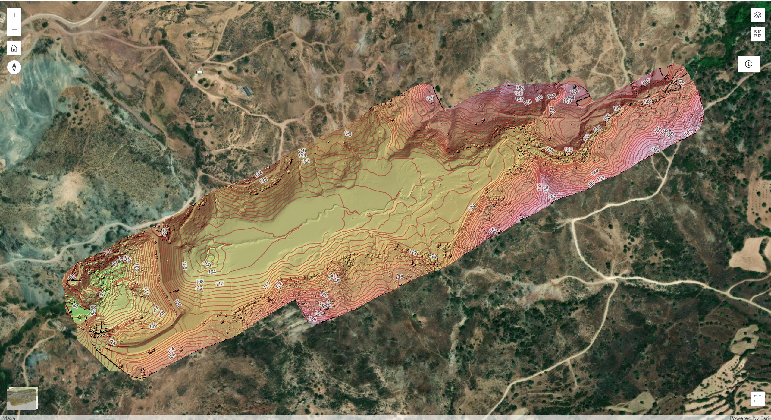
Interactive Web Application Showcasing Mavrokolympos Dam Aerial Survey Results in 2D and 3D
Additionally, the team developed a web application in ArcGIS Online to publicly showcase the survey results in both 2D and 3D views. The web application includes all the processed data, allowing users to explore the dam’s topography, DEM, DSM, contour lines and orthomosaic interactively. You can view the app through the provided link, where all the detailed findings and visualizations are accessible to the public for further research and analysis.
This survey plays a crucial role in advancing water management efforts and environmental research, and a follow-up survey will be conducted post-sediment removal for more detailed assessments.
Web Application Link: Mavrokolymbos Dam Web App