
Successful Aerial Survey of Mavrokolympos Dam – Delivered at Water Development Department
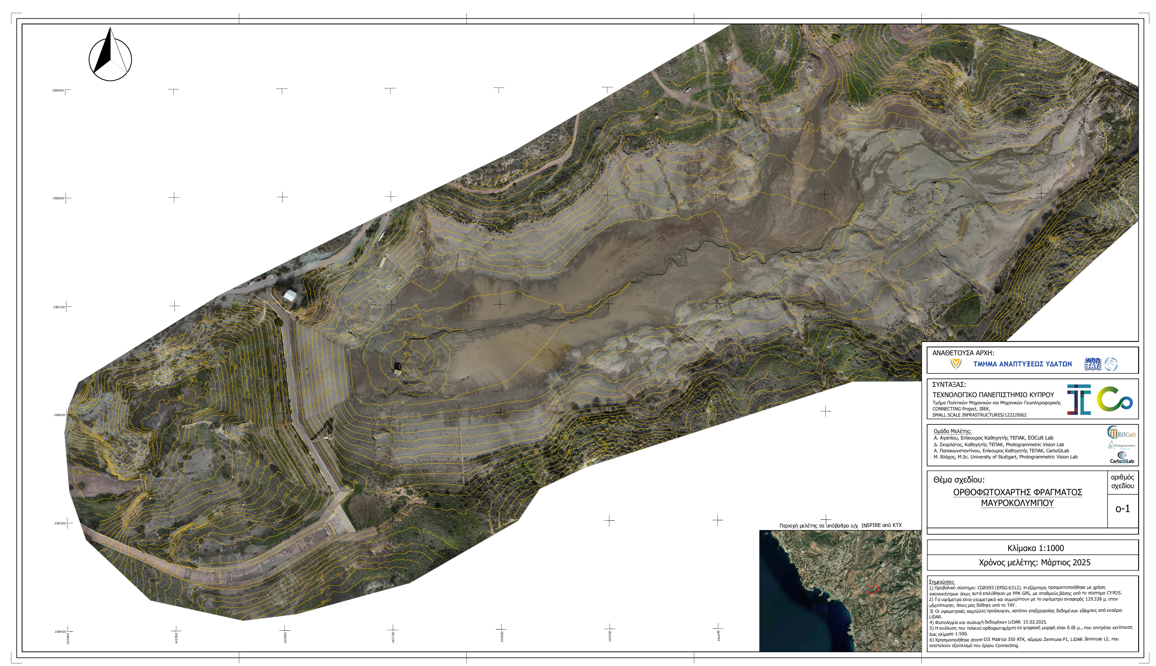
On February 15, 2025, a team of scientists from the Cyprus University of Technology (CUT) successfully conducted a detailed aerial survey of the Mavrokolympos Dam in Paphos. The survey was carried out using state-of-the-art drone technology equipped with high-resolution cameras and LiDAR sensors.
The team utilized the DJI Matrice 350 RTK drone, along with the Zenmuse P1 camera and Zenmuse L2 LiDAR system, to capture precise topographical data. The collected data was processed using the CGRS93 coordinate reference system (EPSG:6312), ensuring high accuracy in the final outputs.
The survey results include a high-resolution orthophoto and detailed elevation data, aligned with the reference height of 129.338 meters, as provided by the Water Development Department. These findings will contribute to ongoing research and future water management efforts.
Furthermore, the team has expressed its readiness to conduct a follow-up survey once sediment removal operations are completed. This will allow for an accurate assessment of the volume of materials extracted, aiding in further environmental and hydrological analysis.